


Vienna Voting District, Maries County, Missouri
About
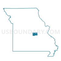
Outline

Summary
| Unique Area Identifier | 609064 |
| Name | Vienna Voting District |
| County | Maries County |
| State | Missouri |
| Area (square miles) | 126.57 |
| Land Area (square miles) | 125.41 |
| Water Area (square miles) | 1.16 |
| % of Land Area | 99.08 |
| % of Water Area | 0.92 |
| Latitude of the Internal Point | 38.21273370 |
| Longtitude of the Internal Point | -91.92944030 |
Maps


Graphs
Select a template below for downloading or customizing gragh for Vienna Voting District, Maries County, Missouri


Neighbors
Neighoring Voting District (by Name) Neighboring Voting District on the Map
- Argyle Voting District, Osage County, MO
- Belle Voting District, Maries County, MO
- Brinktown Voting District, Maries County, MO
- Freeburg Voting District, Osage County, MO
- Hayden Heights Voting District, Maries County, MO
- Hodgeville Voting District, Maries County, MO
- Koeltztown Voting District, Osage County, MO
- Mason Ridge Voting District, Maries County, MO
Top 10 Neighboring County Subdivision (by Population) Neighboring County Subdivision on the Map
- Washington township, Osage County, MO (3,434)
- Jefferson township, Maries County, MO (2,869)
- Jackson township, Maries County, MO (2,164)
- Jackson township, Osage County, MO (1,376)
- Miller township, Maries County, MO (1,110)
- Boone township, Maries County, MO (660)
- Dry Creek township, Maries County, MO (631)
- Spring Creek township, Maries County, MO (394)
Top 10 Neighboring Place (by Population) Neighboring Place on the Map
Top 10 Neighboring Unified School District (by Population) Neighboring Unified School District on the Map
- Osage County R-III School District, MO (6,495)
- Maries County R-II School District, MO (5,501)
- Maries County R-I School District, MO (4,026)
Top 10 Neighboring State Legislative District Lower Chamber (by Population) Neighboring State Legislative District Lower Chamber on the Map
Top 10 Neighboring State Legislative District Upper Chamber (by Population) Neighboring State Legislative District Upper Chamber on the Map
Top 10 Neighboring 111th Congressional District (by Population) Neighboring 111th Congressional District on the Map
Top 10 Neighboring Census Tract (by Population) Neighboring Census Tract on the Map
- Census Tract 4903, Osage County, MO (3,536)
- Census Tract 8803, Maries County, MO (3,517)
- Census Tract 8801, Maries County, MO (2,927)
- Census Tract 8802.98, Maries County, MO (2,732)
- Census Tract 4904, Osage County, MO (2,528)
Top 10 Neighboring 5-Digit ZIP Code Tabulation Area (by Population) Neighboring 5-Digit ZIP Code Tabulation Area on the Map
- 65459, MO (8,233)
- 65013, MO (3,515)
- 65582, MO (2,181)
- 65035, MO (1,826)
- 65085, MO (1,240)
- 65058, MO (1,017)
- 65580, MO (829)
- 65001, MO (414)